I have to confess I am a white-knuckle flyer, as I hate air turbulence. When bouncing in the clouds, worrying about my fate, I often think of “Hurricane Hunters”—the crazy daredevil pilots who fly right into the eye of a storm. My thought process is: if these guys can survive the bumps of Katrina or Sandy, then I can certainly make it to L.A.
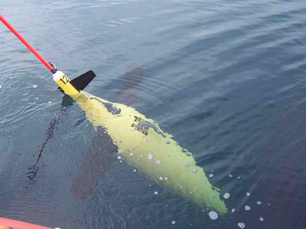
Recently, I discovered the newest wave of hurricane data is coming from underwater robotic “gliders,” submarine-like, underwater bots. Gliders have been used in the past for varieties of research, including tracking shark migrations and water-quality changes.
This hurricane season, the Office of Naval Research and the National Oceanic and Atmospheric Administration will deploy a robotic fleet to better predict hurricane weather patterns in the Atlantic Ocean. Already, gliders were used to monitor Tropical Storm Gabrielle and Hurricane Humberto in 2013.
The gliders move through the water and dive beneath the surface, said Zdenka Willis, program director of NOAA’s U.S. Integrated Ocean Observing System.
“When storms are moving along our coasts, lives depend on accurate forecasts,” Willis said. “The unmanned gliders will allow us to collect data even in the middle of the storm and eventually provide this information to NOAA’s National Weather Service to help improve forecast precision so decision makers can keep people safe.”
In the past, NOAA has used a system that includes fixed-point weather buoys, satellites (providing a bird’s-eye view) and other data collected from ships and planes. Of course, the difference is that the gliders travel through the sea on a course that can be programmed in advance and changed mid-mission, if necessary. When the glider moves to the surface, the data is uplinked to satellites to give researchers a real-time look at conditions in areas that historically have been inaccessible to provide more accurate weather forecasting.
The project that started out in triangles between New England and the New Jersey coast has grown to a team of 16 gliders operating in the ocean at any given time. While the 53rd Weather Reconnaissance Squadron courageously flies into the eye of the storm at 30,000 feet, down below the gliders sail through the water to make a very powerful “Category 5” team, sheltering us from the storms ahead.
Image credit: NOAA’s National Ocean Service
Video credit: NOAA’s National Ocean Service